Our Projects
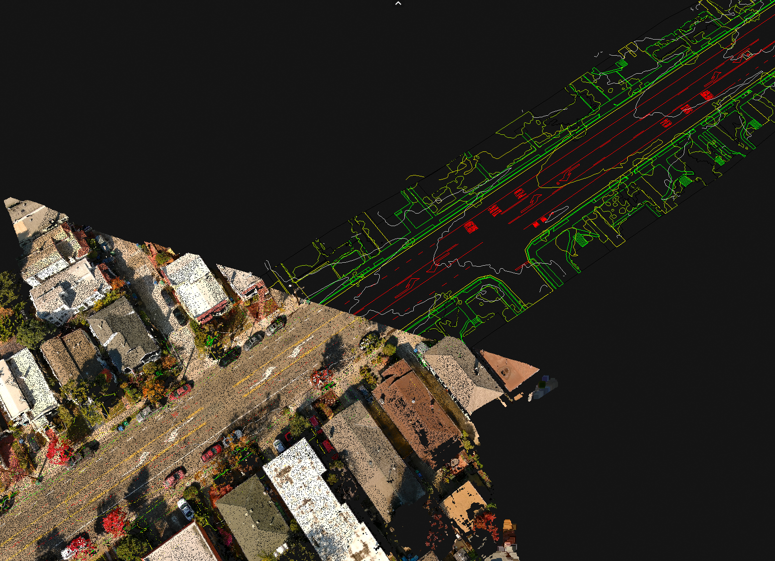
Quiet River Land Services
Znap Fly provided drone mapping, data processing using ground controls for this roadway improvement project. Processed deliverables included 3D point cloud model, stitiched mosaic map, and AI generated CAD Linework. All in a week turn around.
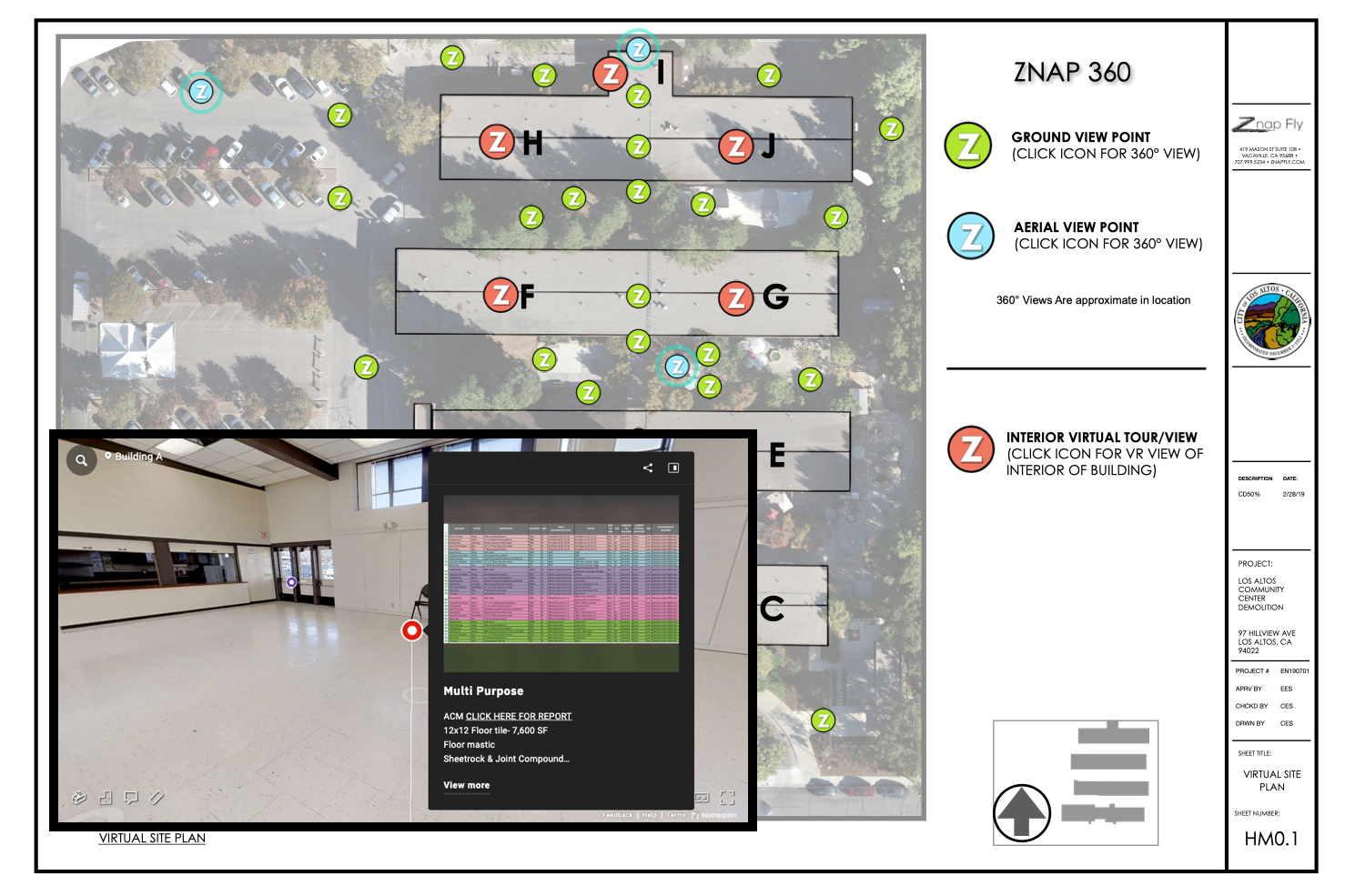
City of Los Altos Hillview Center
Znap Fly provided project data capture for this multi building demolition construction project. Deliverables included aerial imagery, floorplan generation, 3d virtual site walk data of site with tagged information. Project was completed on time and under budget.

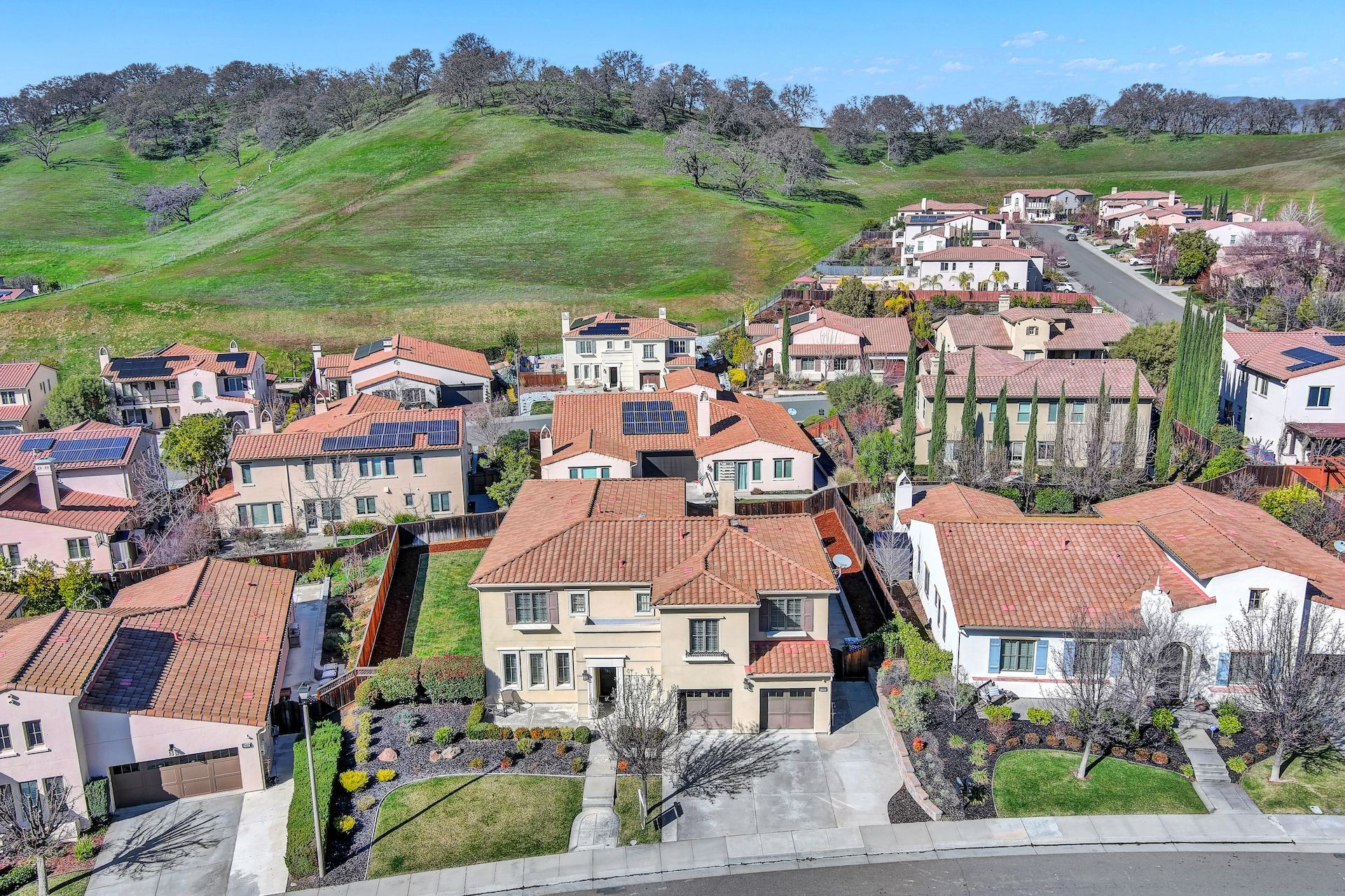
Real Estate Project
Znap Fly provided media production services for this property listing.
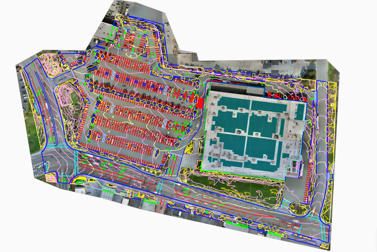
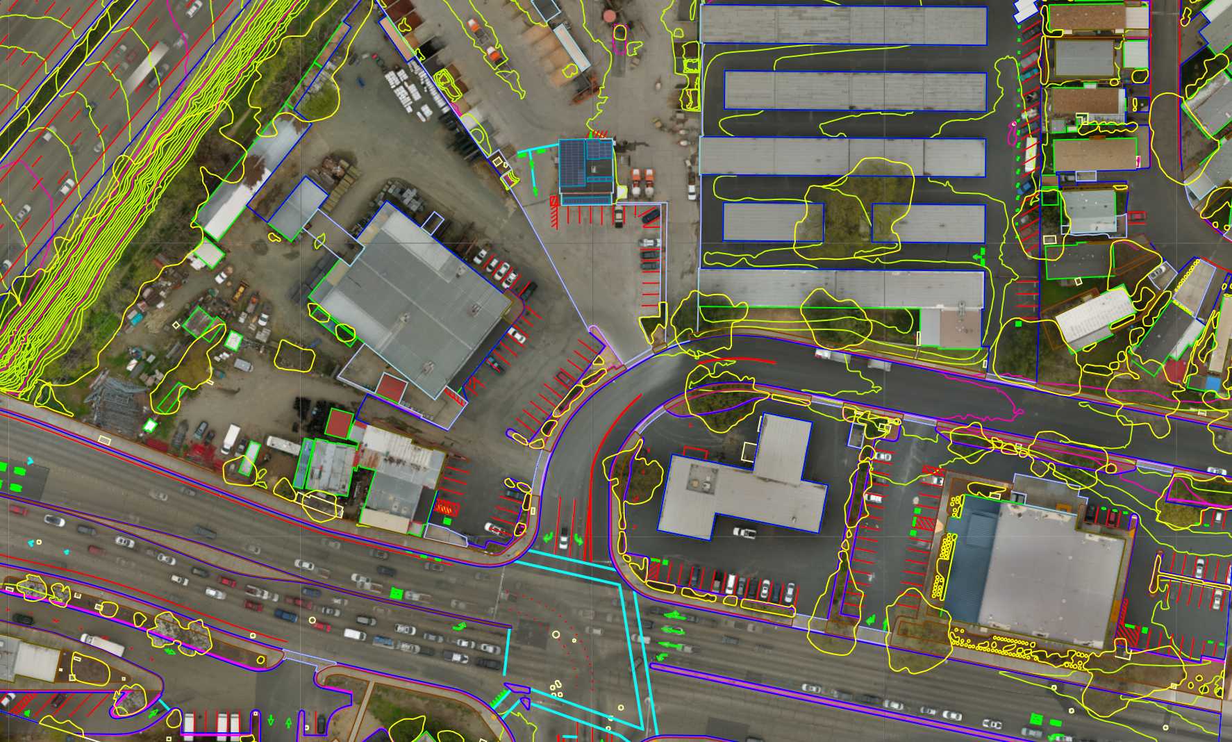
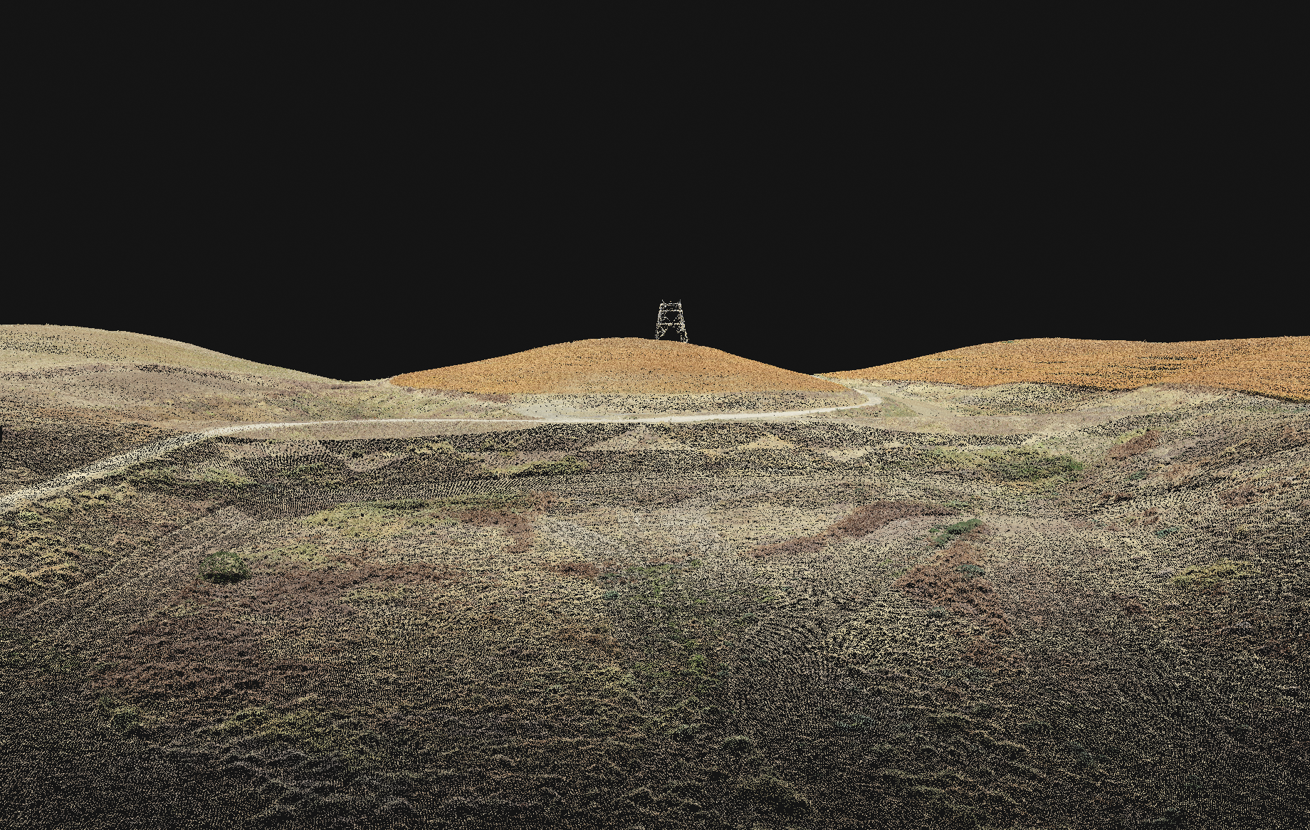
ALTA Survey Drone Data
Znap Fly captured aerial data and processed full data for Sousa Land Surveying. Deliverables included 3D point cloud data, mosaic map image, CAD Linework. Work compoleted in days for this ALTA Survey
Real Estate Media
Znap Fly provided media production services for this property listing.
UC Davis Design
Znap Fly was hired and provided aerial imagery for design study at University of California Davis. 3D Model, aerial imgages, CAD Linework.
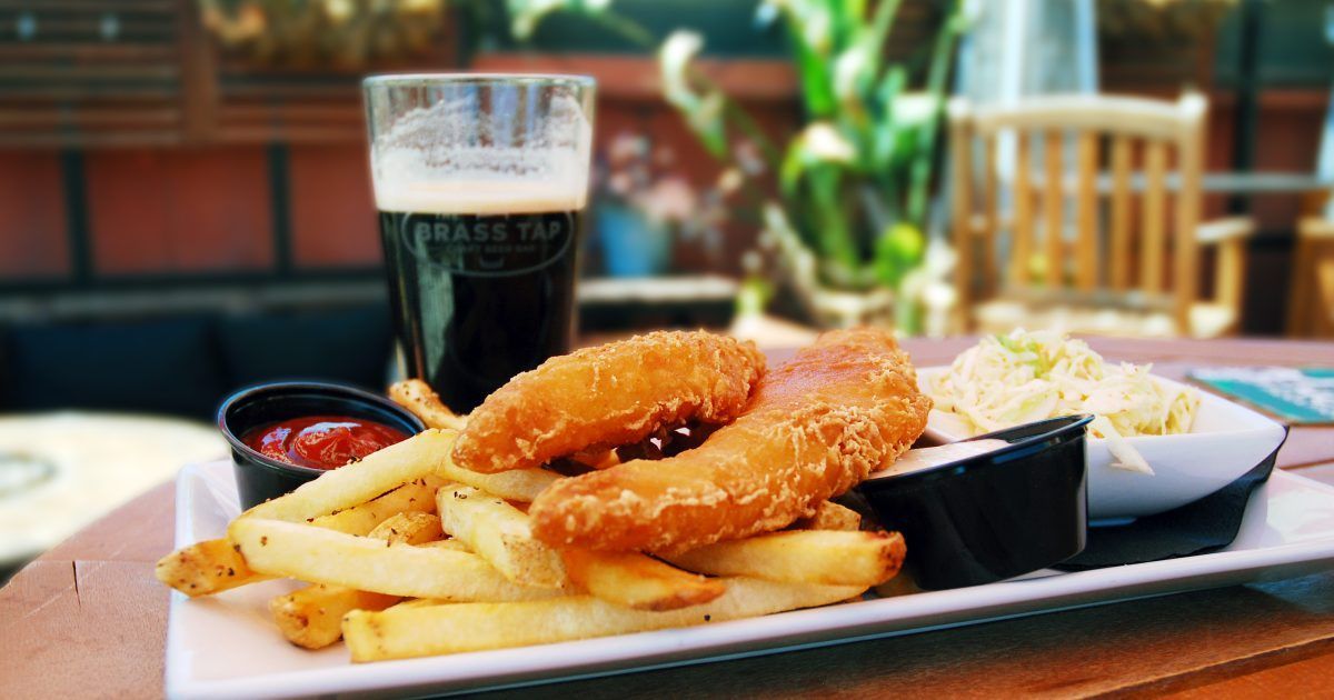
Brass Tap Commercial
Znap Fly produced a fun and exciting cinematic commercial add for the Brass Tap located in Vacaville
Construction Progression
Znap Fly provided aerial drone imagery for Clark Pacific construction.
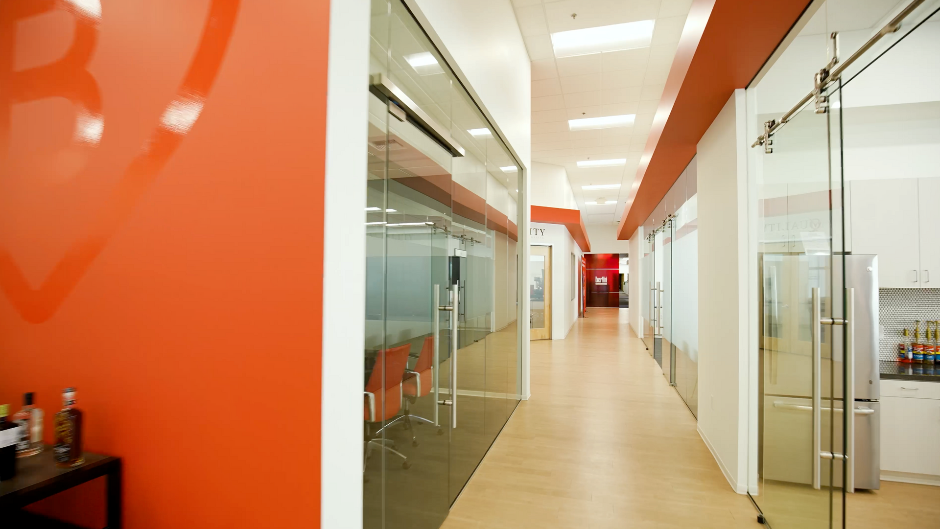
Berlin Packaging
Znap Fly produced a cinematic video with aerial and ground footage of this packaging plant. Berlin uses this media content for website and marketing.
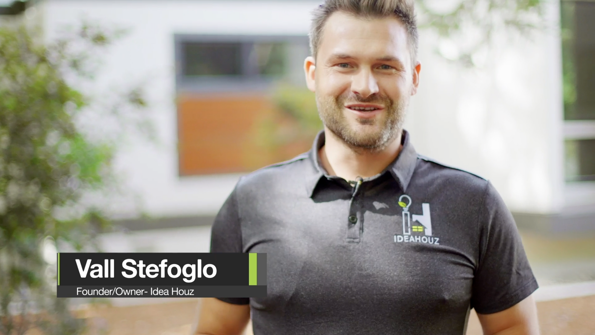
Idea House
Znap Fly created a showcase video for Idea House a general contractor for this upscale renovation project in Fair Oaks Ca.
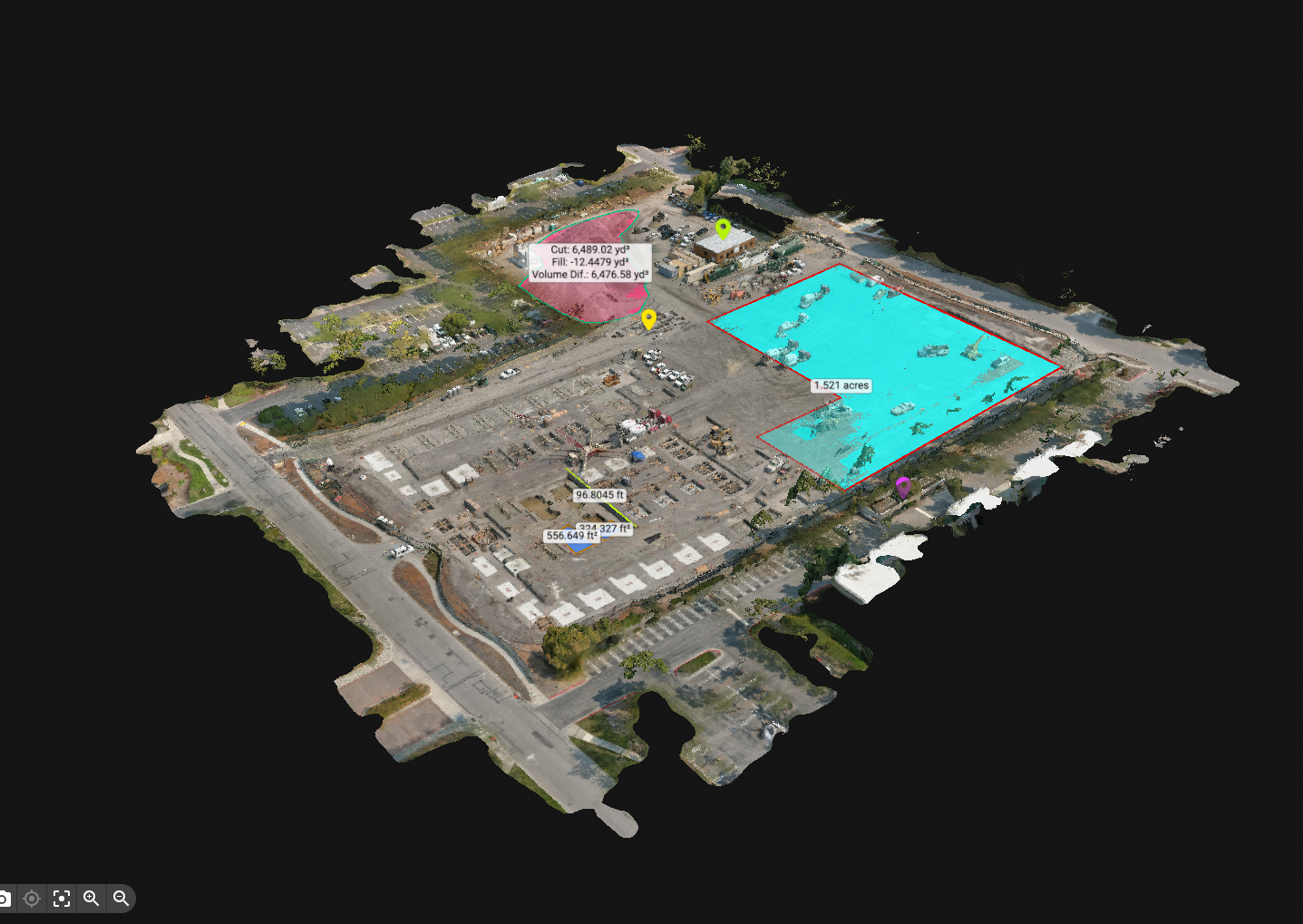
Asta Construction
Znap Fly captured aerial data for Asta Construction, providing imagery and elevation contours for project closeout
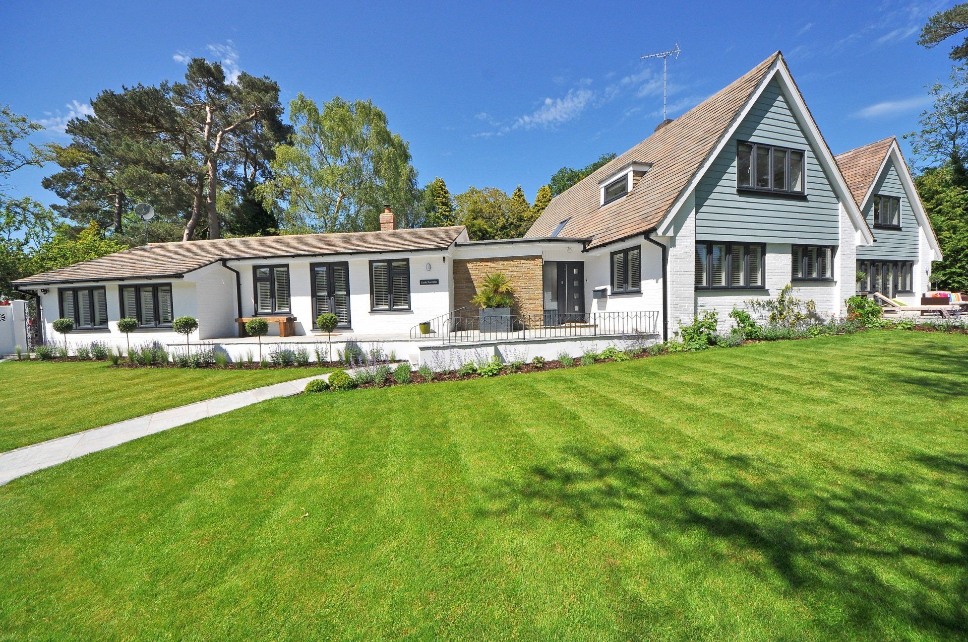
Real Estate Media
Znap Fly provided media production services for this property listing.