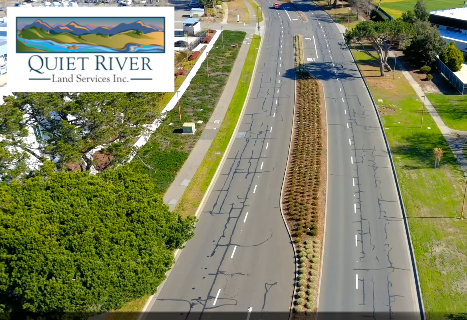
CONSTRUCTION
DATA
BRINGING YOUR DATA TO LIFE
with the power of imagery.
DRONE MAPPING
We've got the experience you need.
VIDEO DOCUMENTATION
Learn more →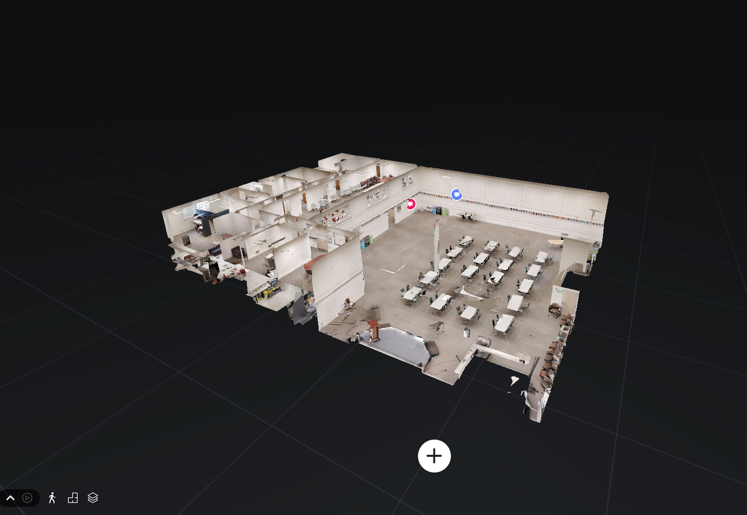
3D Virtual Site Walk
Learn more →DRONE MAPPING
Overview
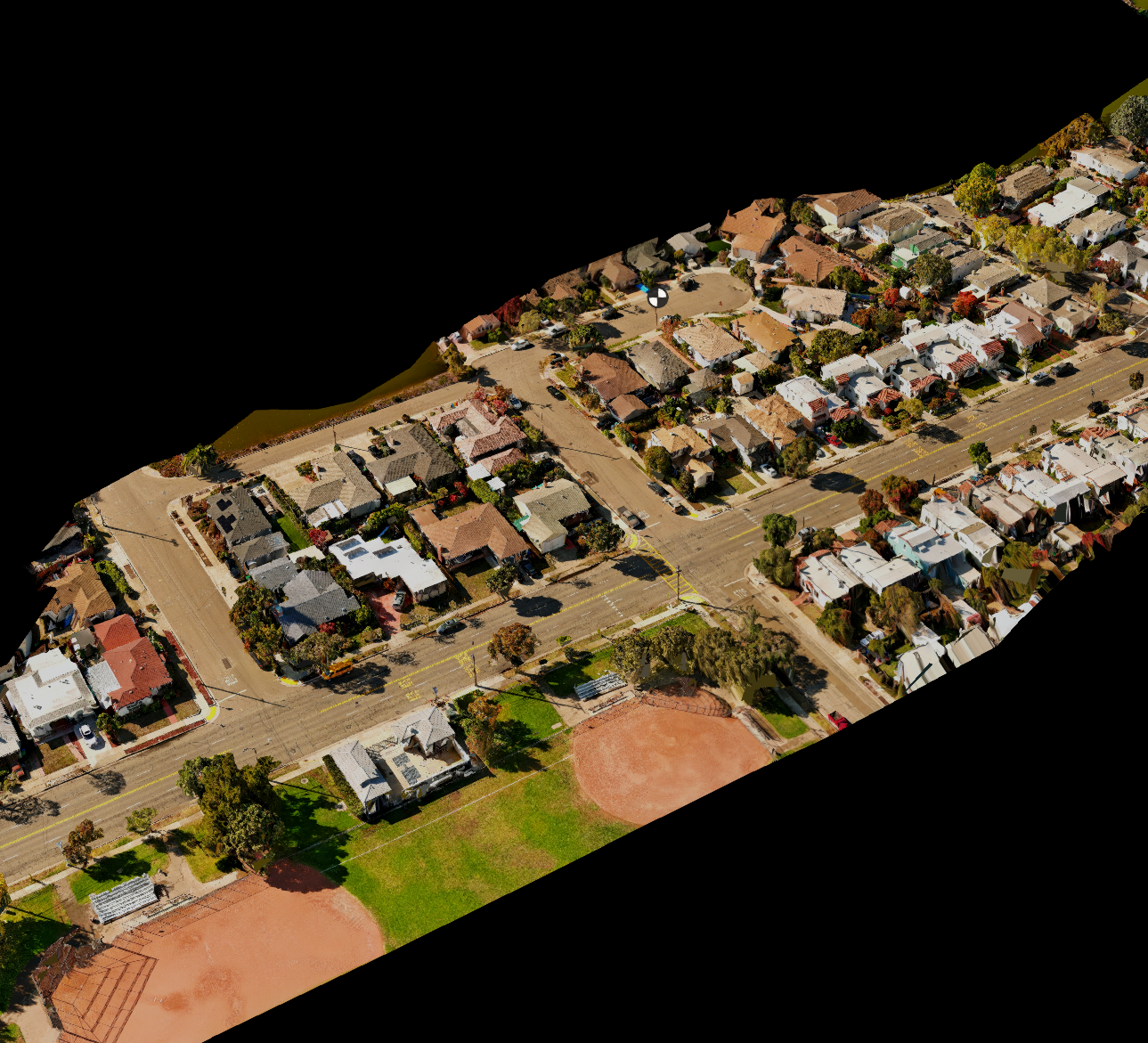
Znap Fly quickly and accurately provides Land Surveyors, Civil Engineers and Construction Managers with accurate reliable aerial data of various sites. This supplemental data allows our clients to focus on design, management and quality assurance. Making them more efficient and cost effective.
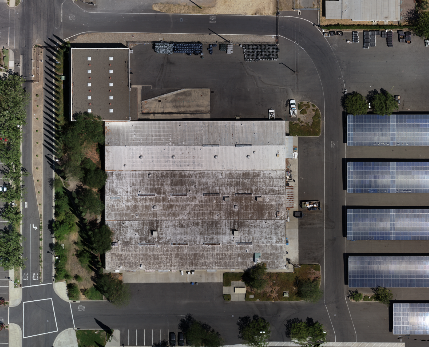
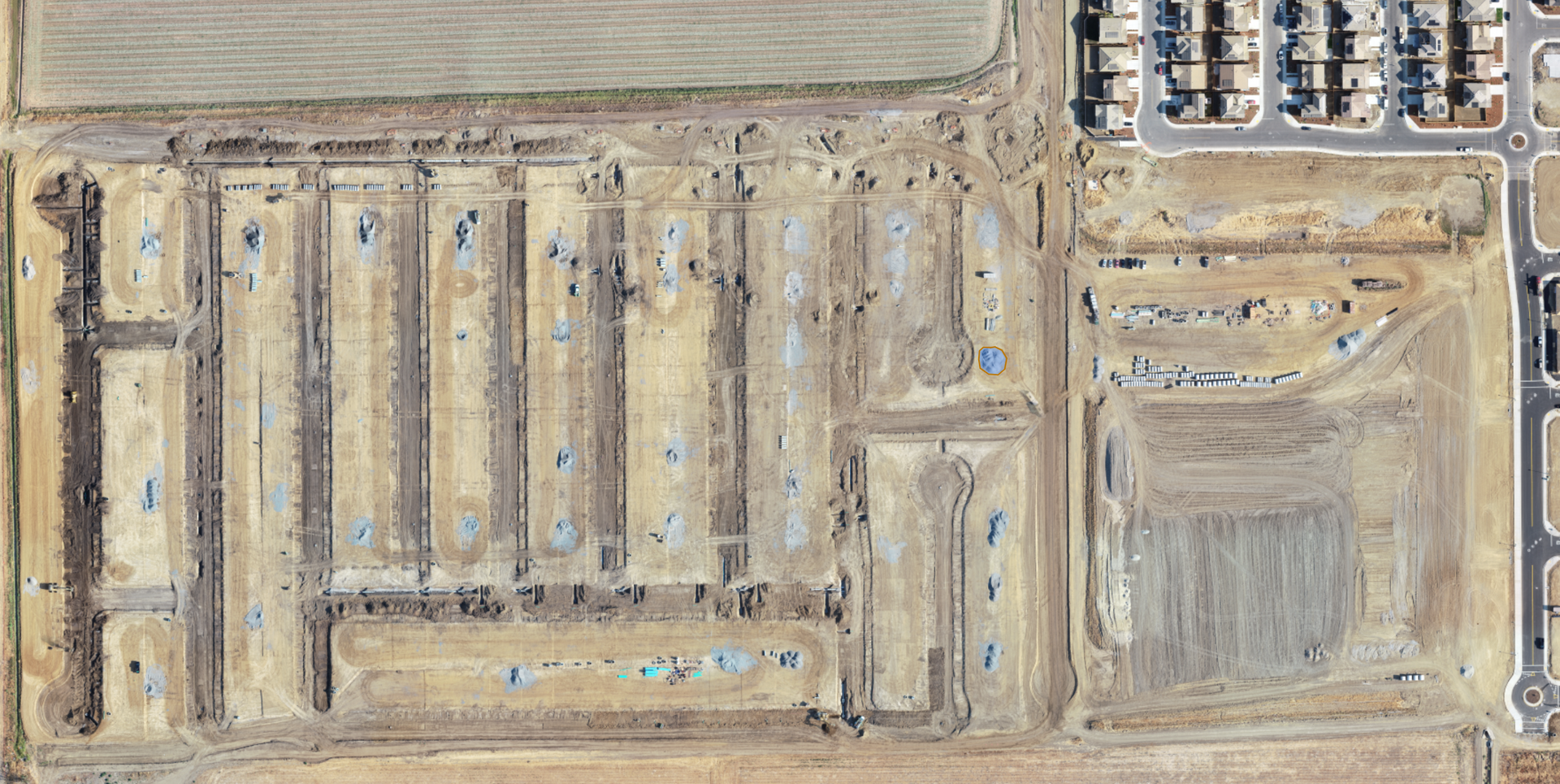
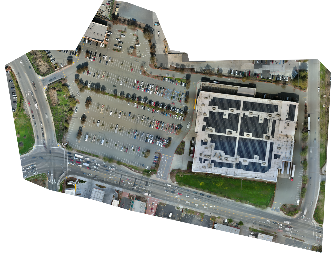
Orthomosaic
Drone mapping orthomosaic refers to the process of creating high-resolution, georeferenced aerial images using a drone or unmanned aerial system (UAS).
Znap Fly's drones equipped with a high-resolution camera captures a series of overlapping images of the target area from different angles. These images are then stitched together using specialized software to create a single composite image that covers the entire area.
Orthomosaic mapping has a wide range of applications, including land surveying, agriculture, environmental monitoring, construction, and urban planning.
3D Model & Cloudshare
Znap Fly's processed 3D model can be shared with project team members, allowing users to measure, label and view the site.
For accurate models Znap Fly will use client provided controls collected in the field, or we can use our aero point flight panels corrected to NAD83 (2011) state plane coordinate system.
Point cloud data can also be exported for use in 3D CAD systems.
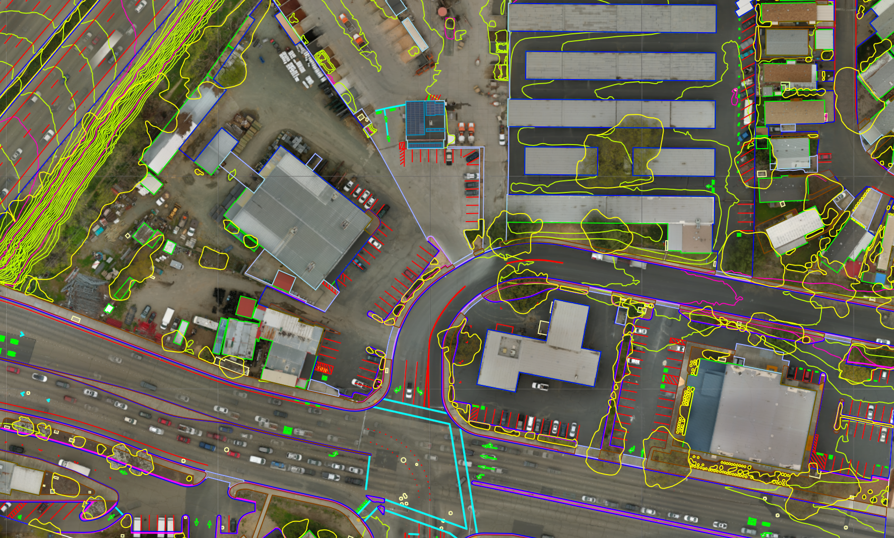
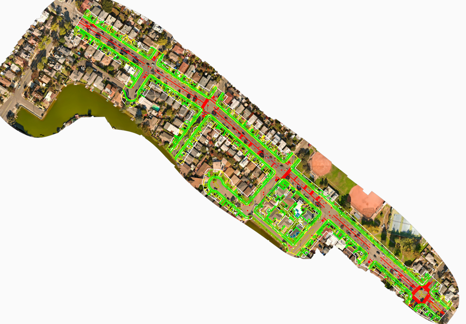
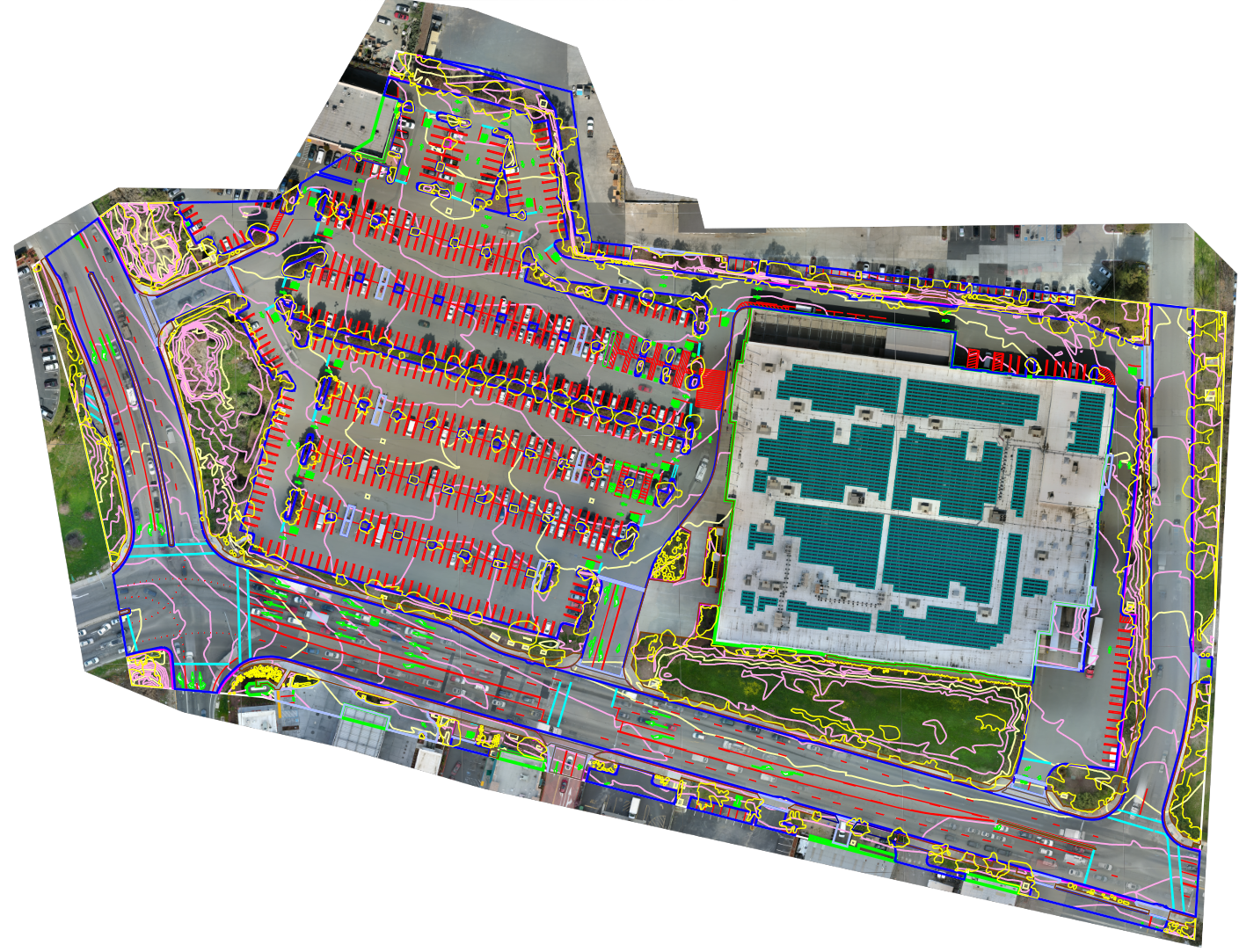
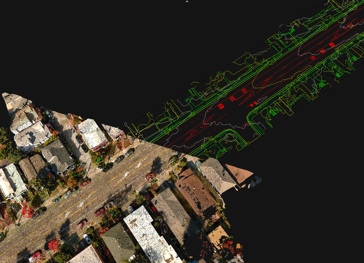
CAD Linework
Znap Fly uses the processed drone data generated and develops CAD Linework for the site in a few days using AI technology.
CAD Linework includes such as buildings, roads, sidewalks, curbs, pavement markings, trees/shrubs, manholes/drains, railroads, and concrete pads, as well as elevation contour topography .
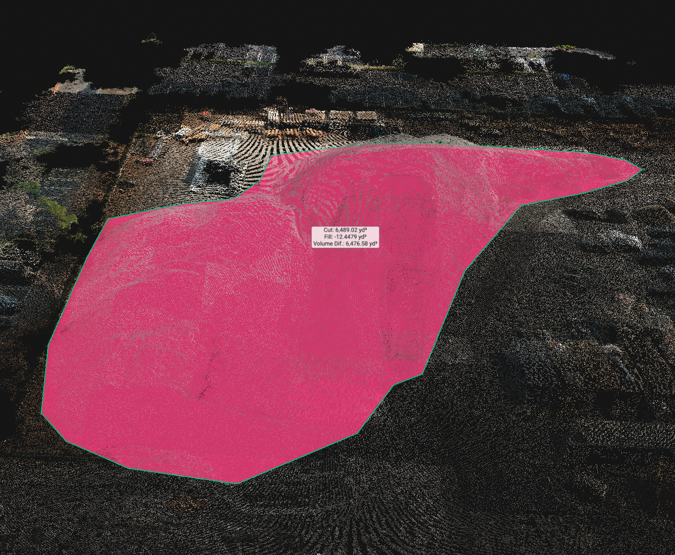
Measure & Annotate
Drones can be used for various purposes, including measuring distances, heights, volumes, and areas. Drone-based measurements offer several advantages over traditional measurement methods, including speed, accuracy, and safety.
Another feature is ability to label key areas and annotate with detail.
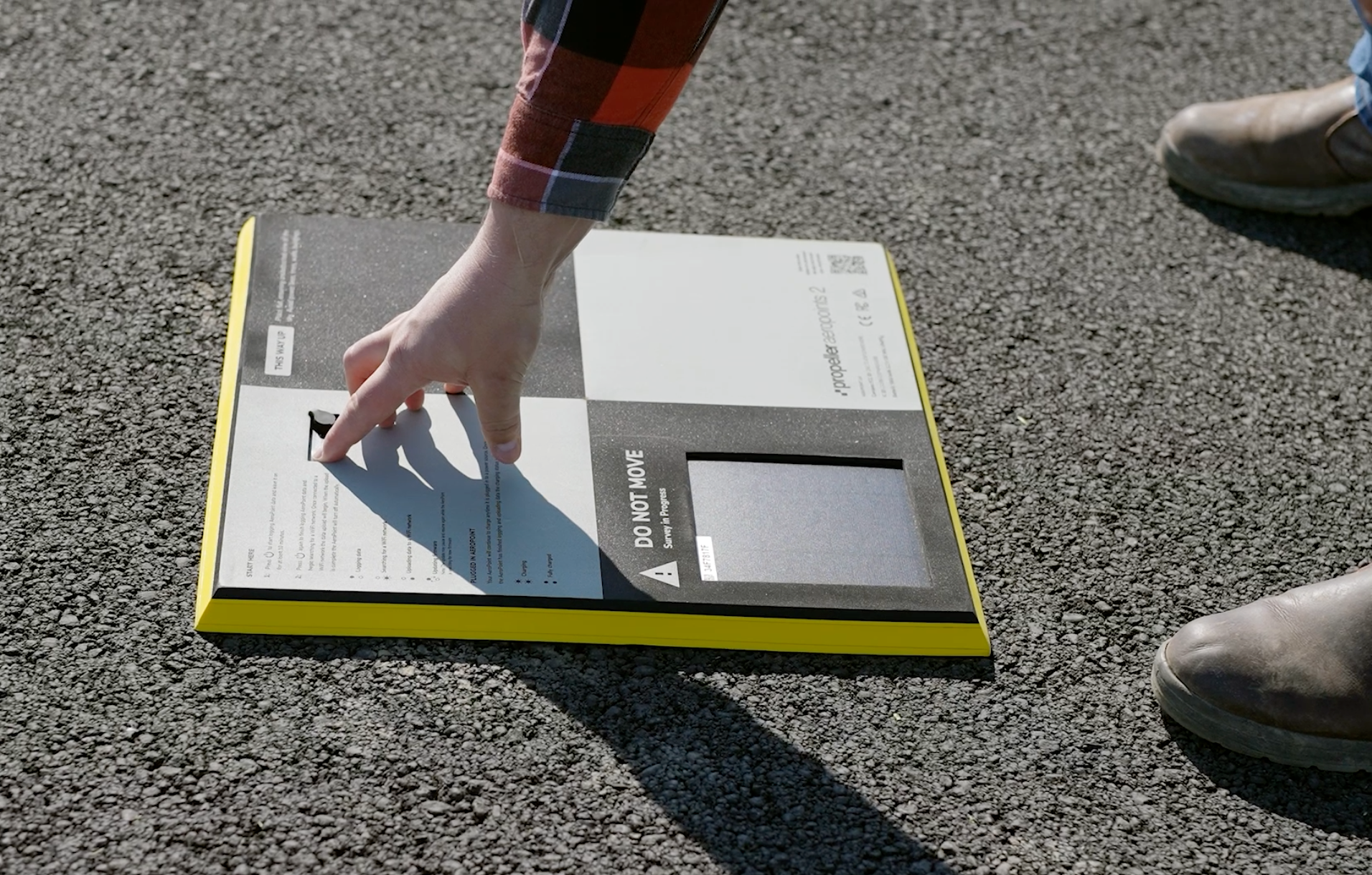
Ground Control
For survey grade data Znap Fly uses client provided controls (GCP) coordinates and uses them to correct the model to the coordinates in state plane.
Znap Fly also has the ability to use Aero Points, however it is up to the surveyor to verify coordinates collected.
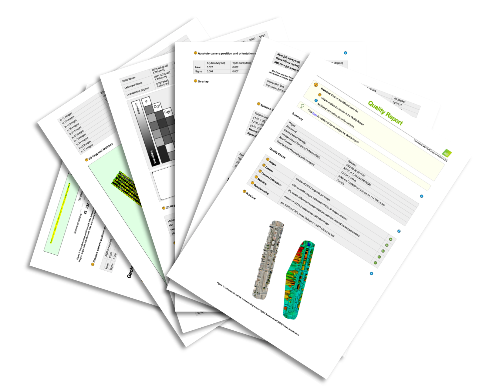
Quality Report
Znap Fly will also provide a quality report verifying the RMSE error of the model.
Including all photogrammetry processing data and accuracy.
Most models are well below an error of 0.1 of 1 US foot
3D Model
Znap Fly can share processed data for viewing, measuring, annotating and investigating elevations
CAD Linework
Znap Fly can provide full CAD Line work for any project. CAD Linework is created with AI technolgy using data captured from the drone. Over 20 CAD layers can be generated.
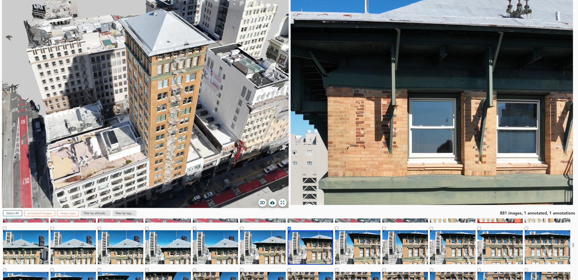
3D Digital Twin Model of high rise. With built in inspection platform accessible through a cloud share link. Annotate Inspect and export a detailed report
FACADE INSPECTION DATA
VIDEO DOCUMENTATION
Video documentation is a powerful tool when managing projects.
- record key milestones
- Investigate during design
- hard to reach or unsafe areas
- communicate status of project with team members and stakeholders
3D Virtual Site Walk
Create a 3D virtual Tour of your project to allow team members and prospective bidders to virtually walk the site. Easy to use tools for measuring and tagging annotation.
Ability to generate point cloud 3D data for importing into AutoCAD Civil 3D and Revit.
How it works

1. Mission Planning
2. Mission Flight
FAA P107 Pilot

3. Data Processing
4. Processed Data
Licenses & Capabilities