
DRONE DATA
#THEEASYWAY
Get actionable data with Znap Fly drone pilots. letting you focus on management and quality assurance.
Licensed Drone Pilots
Knowledgeable in site mapping and data capture. We capture data the right way so you can focus on management. Helping you obtain drone imagery without the capital expense and time, managing an FAA compliant drone program.


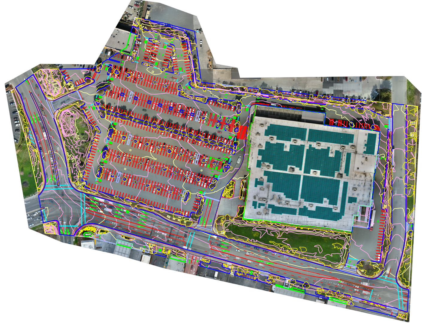
Drone Survey Data
with CAD
Site Documentation
& Inspection
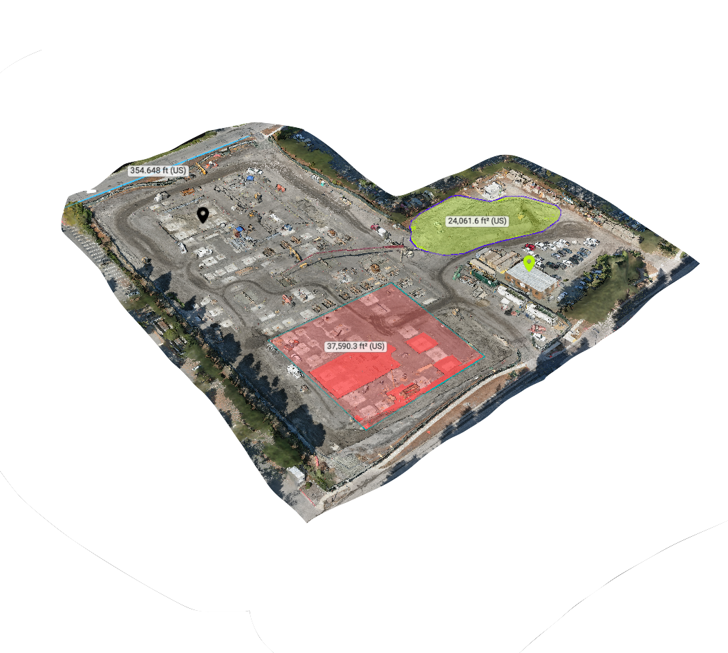
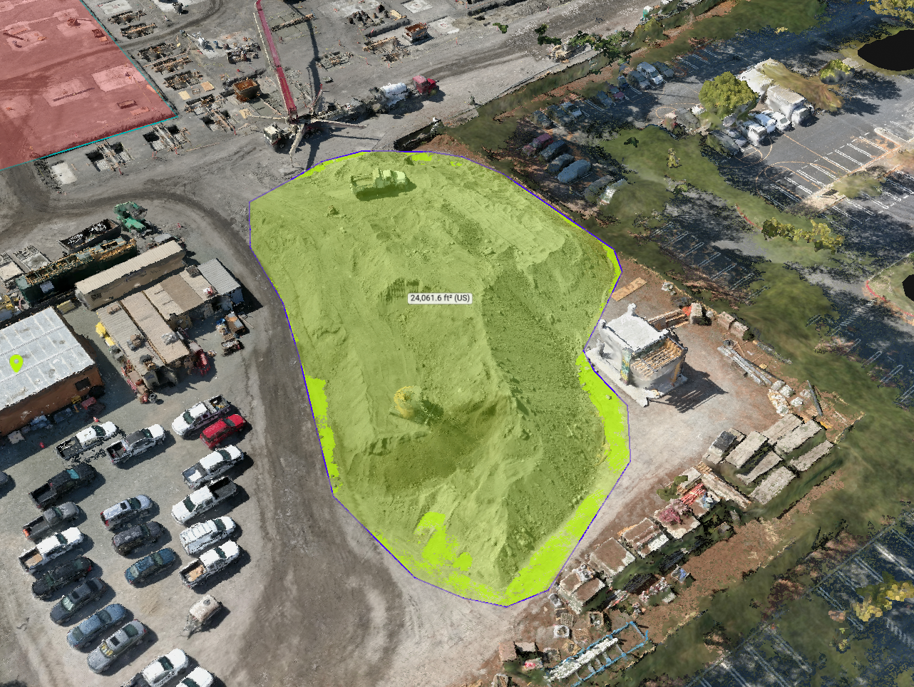
Volumetric Measurement
& Annotation tools
New Paragraph
3D Virtual Site Walk
Create a 3D virtual Tour of your project to allow team members and prospective bidders to virtually walk the site. Easy to use tools for measuring and tagging annotation.
Ability to generate point cloud 3D data for importing into AutoCAD Civil 3D and Revit.
